THE BRIEF
Two programmes, one weekend, and nobody sure where to be
SANCTUM ran the rituals. THE UNIT ran the movement sessions. Guests bought one of five different tickets, and each ticket bought a different subset of the weekend.
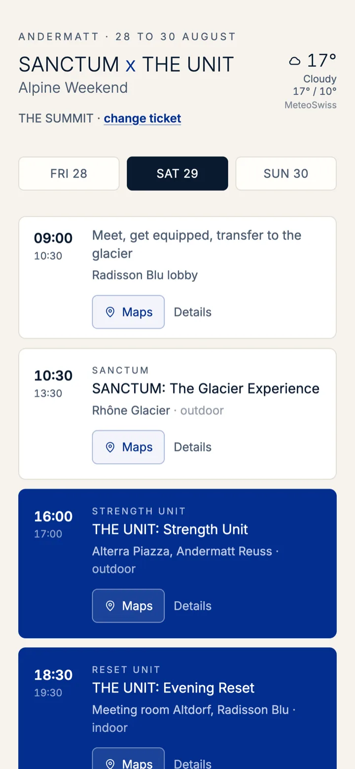
A SUMMIT guest spent Saturday morning on the Rhône Glacier. An ASCENT guest spent it at 2'300 m on the Gütsch. A sponsor's guest came for one day and none of the rituals. The printed brochure showed all of it to all of them, and the locations in it were already wrong by the time the first guest arrived.
The brief was not a booking system. It was a single link that answers one question for one person: what am I doing next, and where do I stand?
THE SCREENS
Six screens, no login, no app store
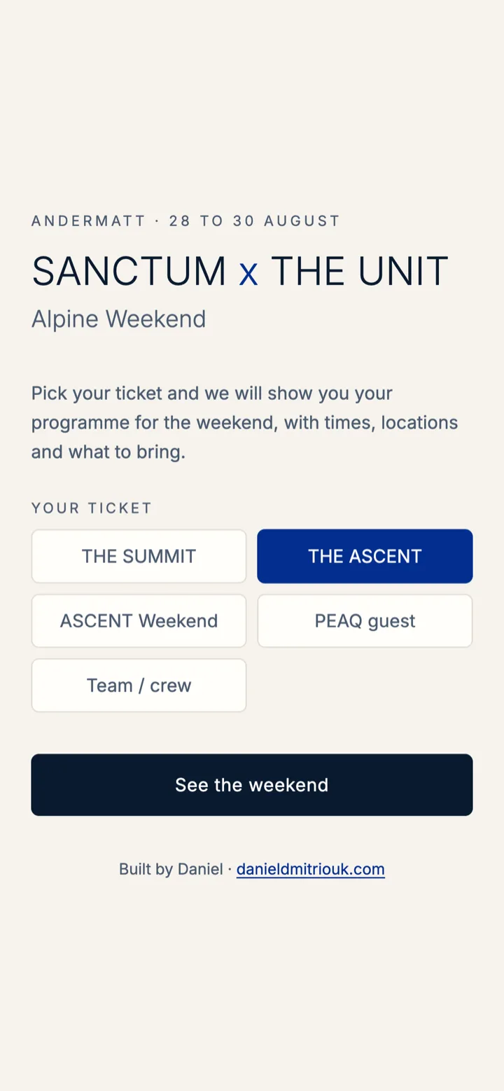
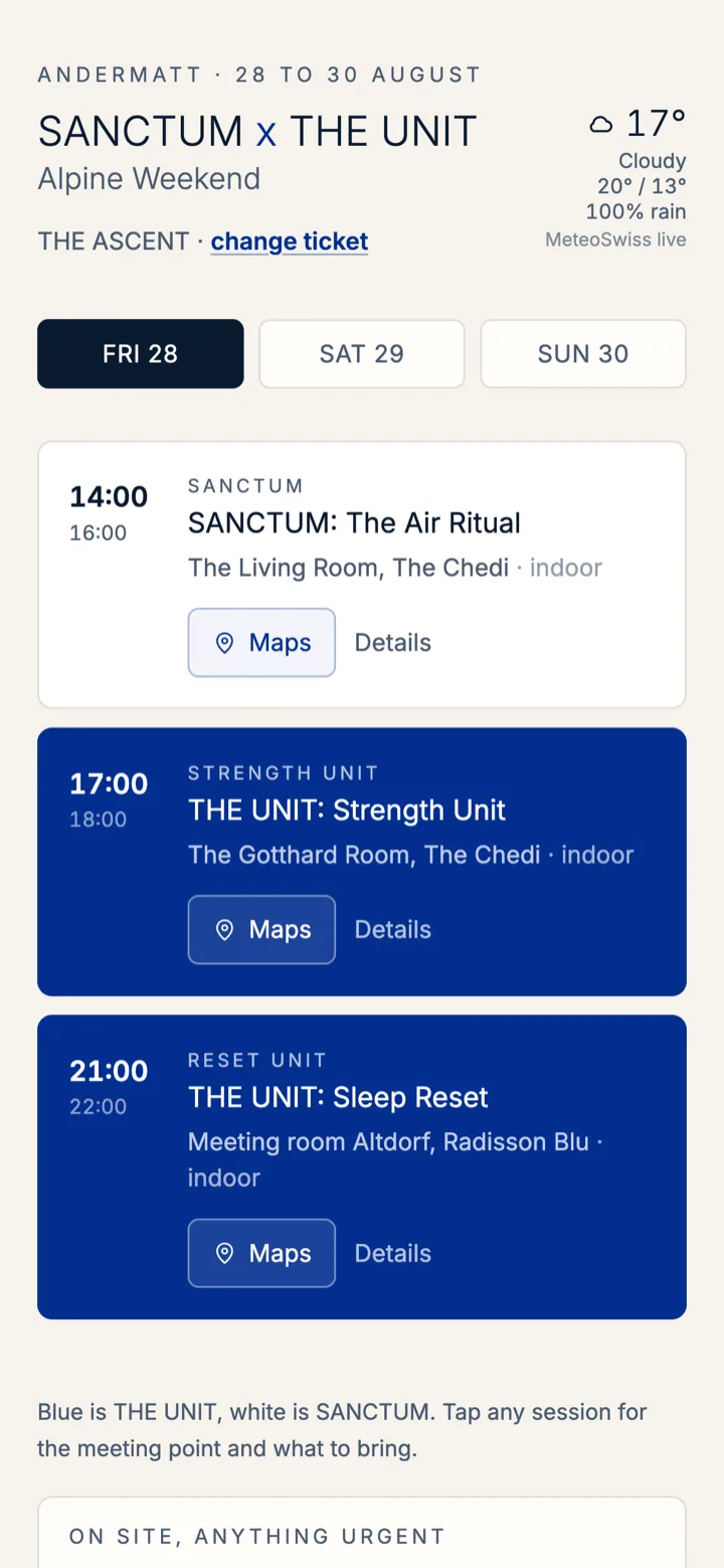
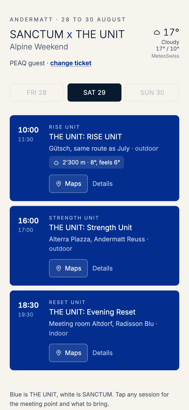
Guests were handed one URL. First visit asks a single question, then the weekend appears, filtered to their ticket and defaulting to today.
WHAT IT DOES
Built for a guest standing outside in the rain
Ticket-aware programme
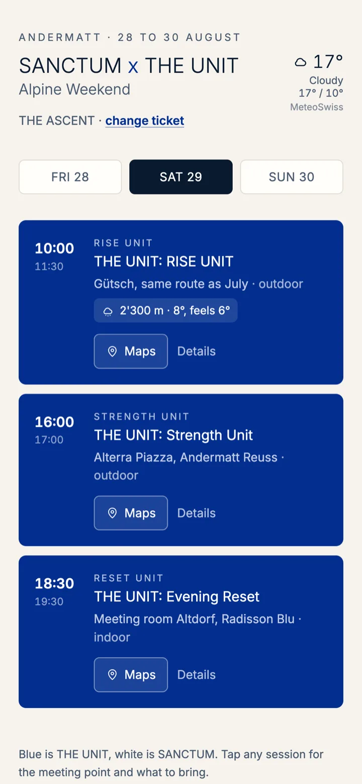
Five ticket types, each with its own days, its own Saturday track and its own access to the rituals. A guest is never shown a session they cannot attend.
Directions to the exact door
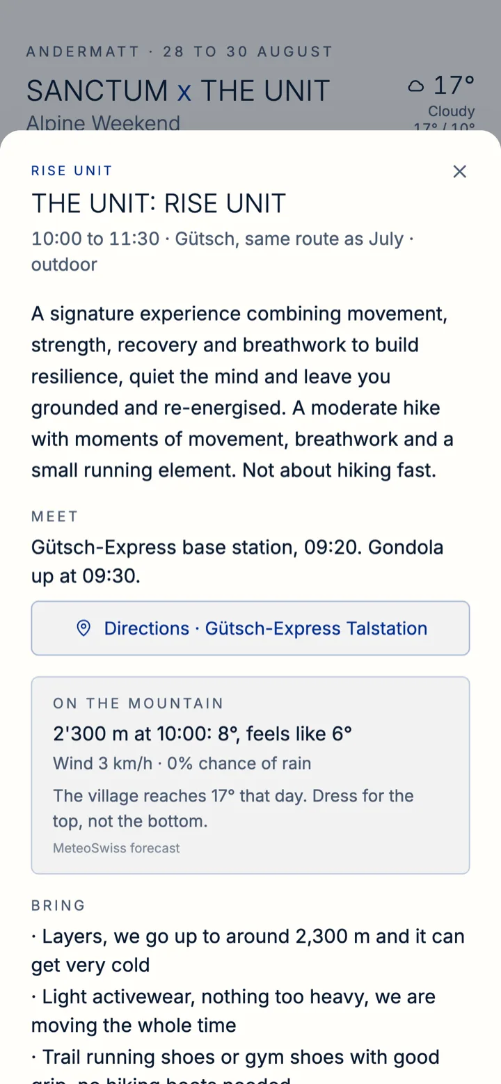
Every session opens Google Maps at its own pin. Two sessions in the same hotel three hours apart point at two different entrances, 150 m apart, because that is the difference between arriving and wandering.
Live MeteoSwiss data
The current temperature comes from the SwissMetNet station in the village, not a forecast model. The model ran three degrees warm. The mountain session reads the station at 2'288 m instead.
Altitude-aware kit lists
The village can be 17° while the session at 2'300 m is 8°. Each card carries the temperature where the session actually happens, next to the layers you need for it.
Updated mid-event
A session moved indoors, changed concept, changed hotel and changed room over the course of one afternoon. Each change was live in under a minute, with no app update and nothing for a guest to reinstall.
Works on a mountain
Static files, 68 kB gzipped, no backend to time out. Animation never gates visibility, so a page that loads in a backgrounded tab still shows the schedule when the guest comes back to it.
HOW IT IS MADE
Small enough to change during the event
The first build had sign-ups, a database and live capacity counts. Once the real numbers came in it was clear the sharper tool was a schedule nobody has to operate. Cutting the backend halved the page weight and removed every failure mode that mattered on a mountain.
Brief agreed. Schedule and locations pulled from the organiser's email thread.
First working version, reviewed on a phone.
Live on Vercel. Ticket filtering, maps and weather in.
Organiser moves a session indoors and to another hotel. Live in 40 seconds.
Room changes again. New pin, new meeting point, live before the session started.